
Additional enforcement locations will increase traffic safety in city communities
Baltimore, MD (Thursday, January 12, 2023) – The Baltimore City Department of Transportation would like to advise motorists that new automated speed enforcement locations will soon be implemented, as part of the City’s Automated Traffic Violation Enforcement System (ATVES).
Baltimore’s ATVES uses automated speed, red-light and commercial vehicle height monitoring cameras to promote safe driving in city communities. This program is designed to increase safety by reducing driver speeds in school zones and decreasing the incidence of vehicles running red lights. The ATVES program also helps to reduce traffic congestion and damage to streets, homes and other infrastructure by commercial vehicles that travel along restricted roadways.
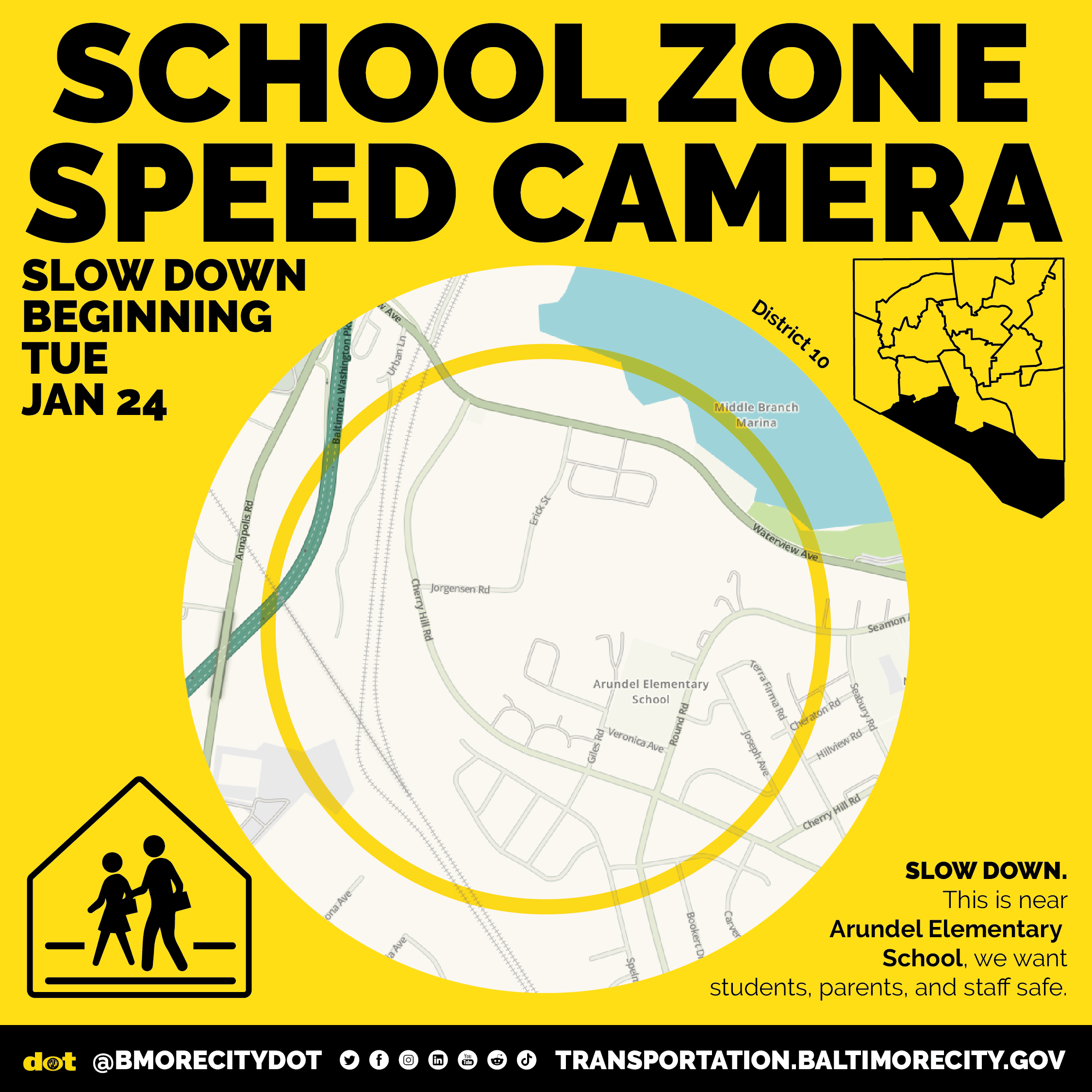
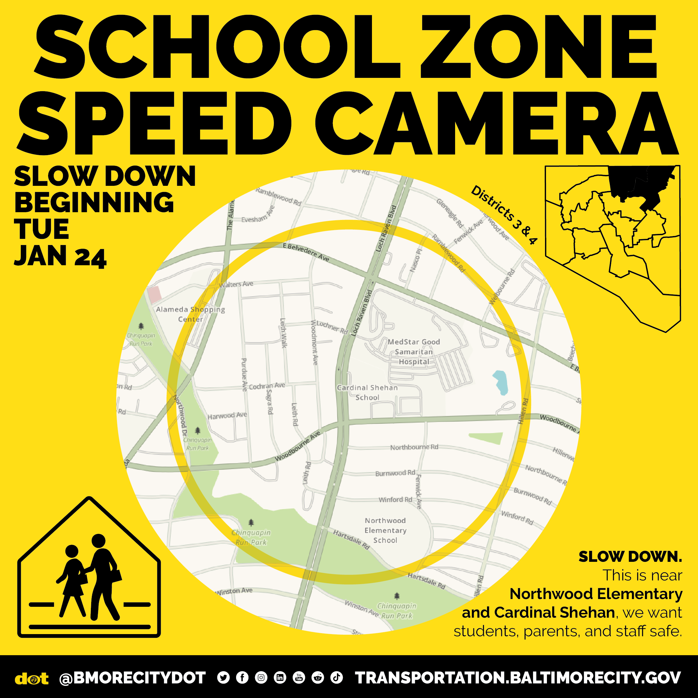
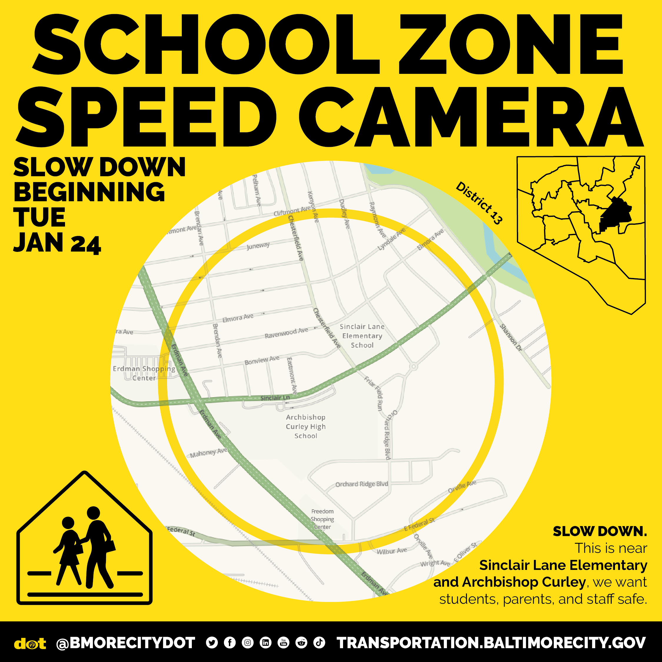
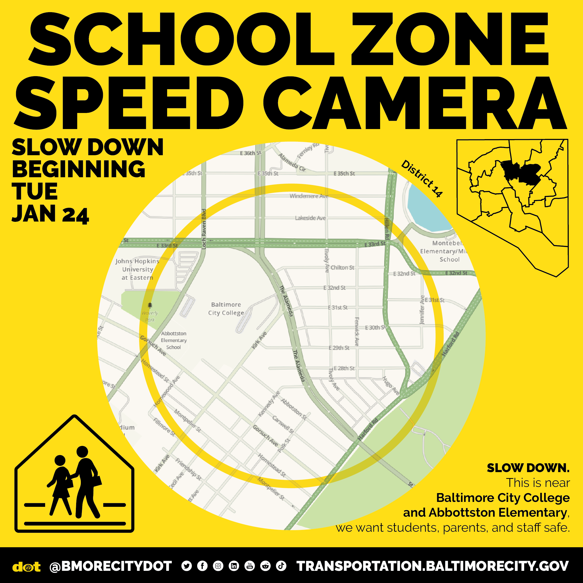
The speed camera monitoring system consists of portable and fixed cameras that detect vehicles which exceed the posted speed limit by at least 12 miles per hour. Speed cameras operate in Baltimore City school zones Monday through Friday, from 6:00 AM to 8:00 PM throughout the year. The speed camera violation fine is $40.00 as set by State Law, and no license points are assessed.
Speed camera implementation will begin on or about Tuesday, January 24, 2023 at the following locations, including multiple directions:
The block ranges and intersections listed above are approximations for the automated enforcement zones. Enforcement at all locations may be on a temporary, rotating, or permanent basis. To learn more about Baltimore’s ATVES program visit: https://transportation.baltimorecity.gov/atvesprogram.
###