The Baltimore City Department of Transportation has been working closely with local, state, and federal partners since the collapse of the Francis Scott Key Bridge early this morning.
The Baltimore City Department of Transportation is actively evaluating the projected impact of the bridge collapse on City corridors, particularly our designated truck routes. Higher traffic volumes on City roads are anticipated, particularly along designated truck route corridors, and the Baltimore City Department of Transportation is actively working on plans to help mitigate the impact on local communities.
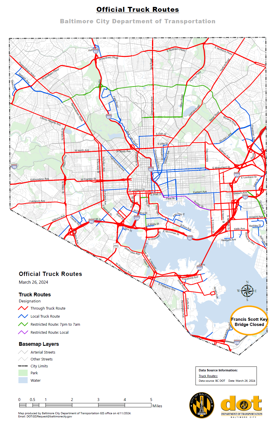
In order to minimize impacts, the Baltimore City Department of Transportation is modifying our official truck map which details how truck drivers may use Baltimore City roads and highways. Please refer to the GIS map for the most up-to-date route information: Baltimore City Official Truck Routes (arcgis.com).
Truckers are encouraged to continue checking this official map in the coming days as additional modifications may be made.
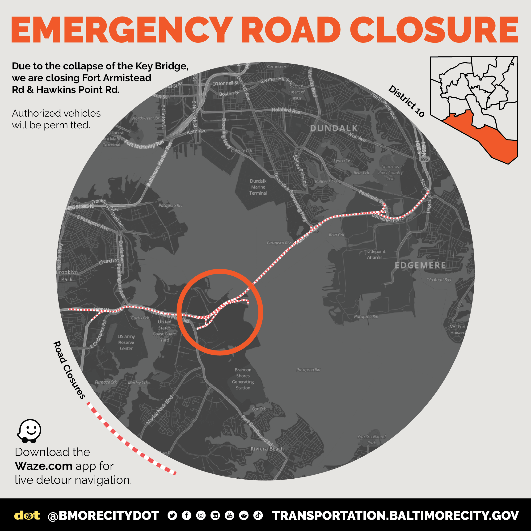
Motorists should also be aware that portions of Fort Armistead Road and Hawkins Point Road are closed at this time. Drivers are encouraged to download the Waze.com app for live detour navigation.